
Highway Lane Types and Rules at a Glance
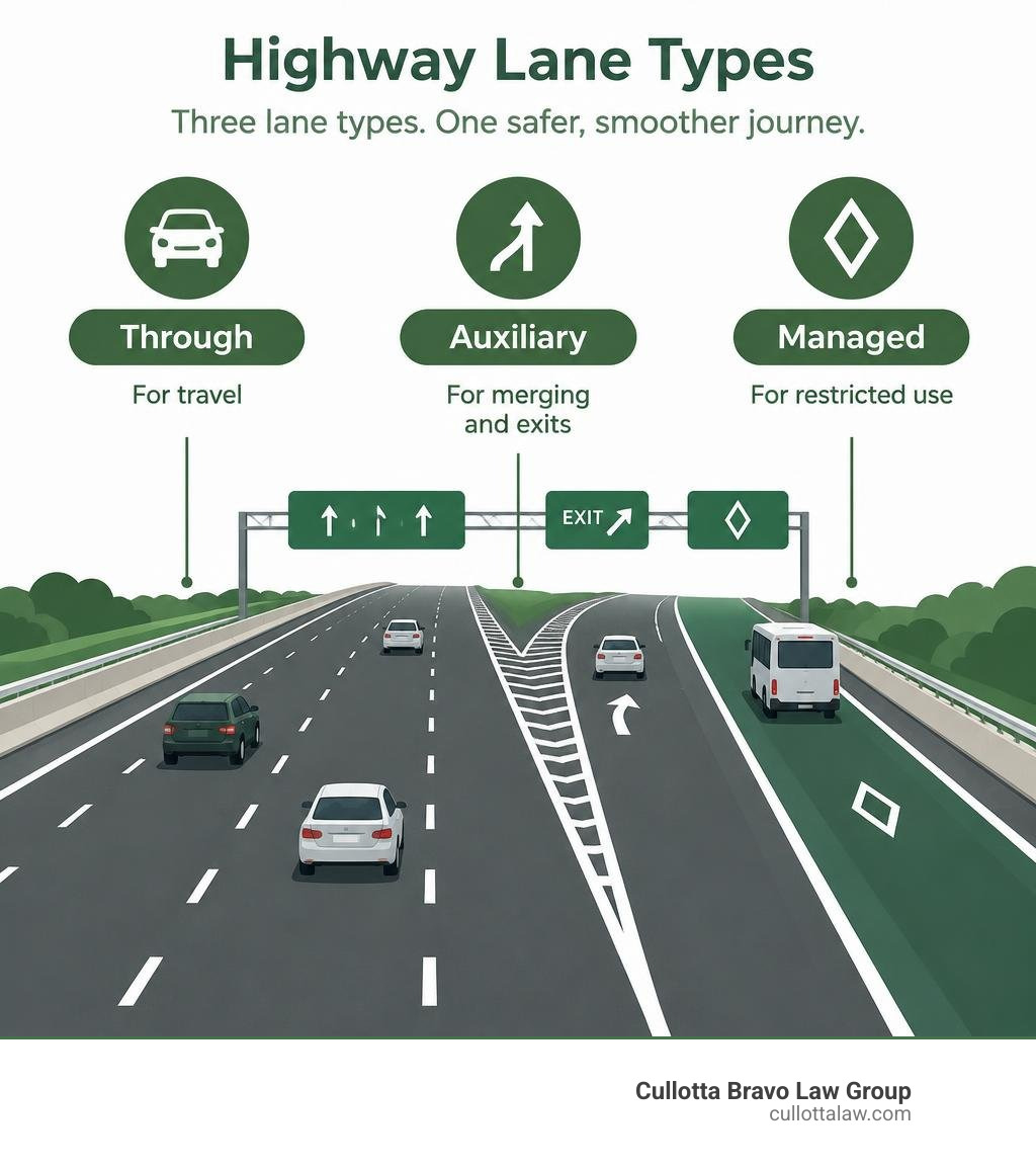
A highway lane is a marked space for travel. Through lanes carry traffic along the road. Auxiliary lanes give drivers room to enter or leave. HOV, bus-only, and other managed lanes limit who can use them or when. To use any lane safely, follow its signs and markings, check your blind spot before changing lanes, and leave room for merging traffic. Specific rules vary by state and roadway.
I’m Peter Cullotta, founding partner of Cullotta Bravo Law Group. For more than 35 years, I’ve represented injured people, and I know how important lane use can be when sorting out what happened in a highway crash.
Introduction
Modern multi-lane highways are the backbone of our transportation network, keeping millions of vehicles moving every day across Illinois and the rest of the nation. Whether you are navigating busy commuter routes like I-88 through Naperville and Aurora, cruising past Joliet on I-80, or driving through the heart of Chicago on I-90/94, highway lanes bring structure and safety to what would otherwise be complete traffic chaos.
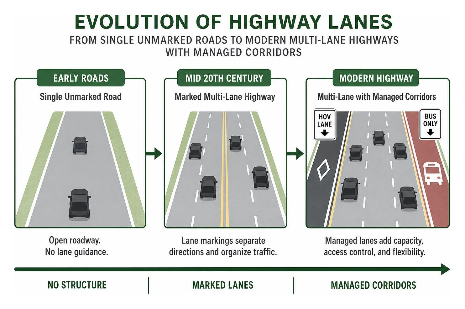
Lane markings feel like a permanent part of driving, but they originated with a single pioneer. In the early 1920s, Dr. June McCarroll of California grew tired of near-collisions on narrow desert roads and hand-painted a white center line down the roadway to separate opposing vehicles. Her idea caught on rapidly. By the late 1930s, standard road striping had spread nationwide. Today, engineered lane systems separate fast-moving traffic, provide deceleration space, organize complex merges, and protect drivers from head-on and sideswipe crashes.
Understanding Highway Lane Types and Designations
Not every lane on an expressway serves the same purpose. Highway engineers design specialized lanes to handle different speeds, turning movements, and traffic volumes. Understanding how these lanes work together helps you make smoother lane changes and stay out of dangerous bottlenecks.
| Lane Type | Primary Function | Vehicle Accessibility | Speed Profile |
|---|---|---|---|
| Through (General Purpose) | Long-distance continuous travel | Open to all street-legal vehicles | Posted highway speed limit |
| Express Lanes | Long-distance travel with fewer exits | All light vehicles; trucks may be restricted | Consistent high speeds |
| Collector-Distributor | Separates merging traffic from mainline | All vehicles entering or exiting | Lower speeds (35–50 mph) |
| HOV / Carpool | Moves high-occupancy vehicles faster | 2+ or 3+ occupants, transit, EV exemptions | Free-flow posted speeds |
| HOT / Managed Toll | Congestion management via pricing | HOV vehicles (free/discount) & solo toll-payers | Variable high-speed flow |
| Auxiliary Lanes | Merging, weaving, and speed transitions | Open to entering, exiting, or climbing traffic | Accelerating / decelerating speeds |
General-Purpose and Through Lanes
Through lanes form the core carriageway of any interstate or primary highway. Their job is simple: carry uninterrupted traffic across urban and rural corridors. On high-speed expressways, these lanes are designed for continuous cruising speeds. Slower traffic is expected to stay toward the right, while the left lanes are reserved for passing. Mixing long-distance commuters with short-trip motorists making frequent lane changes is a primary trigger for slowdowns, which is why larger highways often add separated collector-distributor routes to manage localized exits.
Preferential, HOV, and Managed Highway Lane Configurations
To reduce gridlock without constantly building wider roads, transportation agencies use managed and preferential lanes. High-Occupancy Vehicle (HOV) lanes prioritize carpools, passenger vans, and public transit. High-Occupancy Toll (HOT) lanes use dynamic pricing to let solo drivers buy excess capacity while keeping the lane moving smoothly.
Federal standards outlined in the MUTCD 11th Edition Chapter 2G govern the signage, pavement diamonds, and access gates that control these corridors. Many states allow Inherently Low Emission Vehicles (ILEVs) and electric vehicles access to preferential lanes regardless of passenger count to encourage clean-energy transportation.
Auxiliary Lanes, Shoulders, and Smart Motorway Features
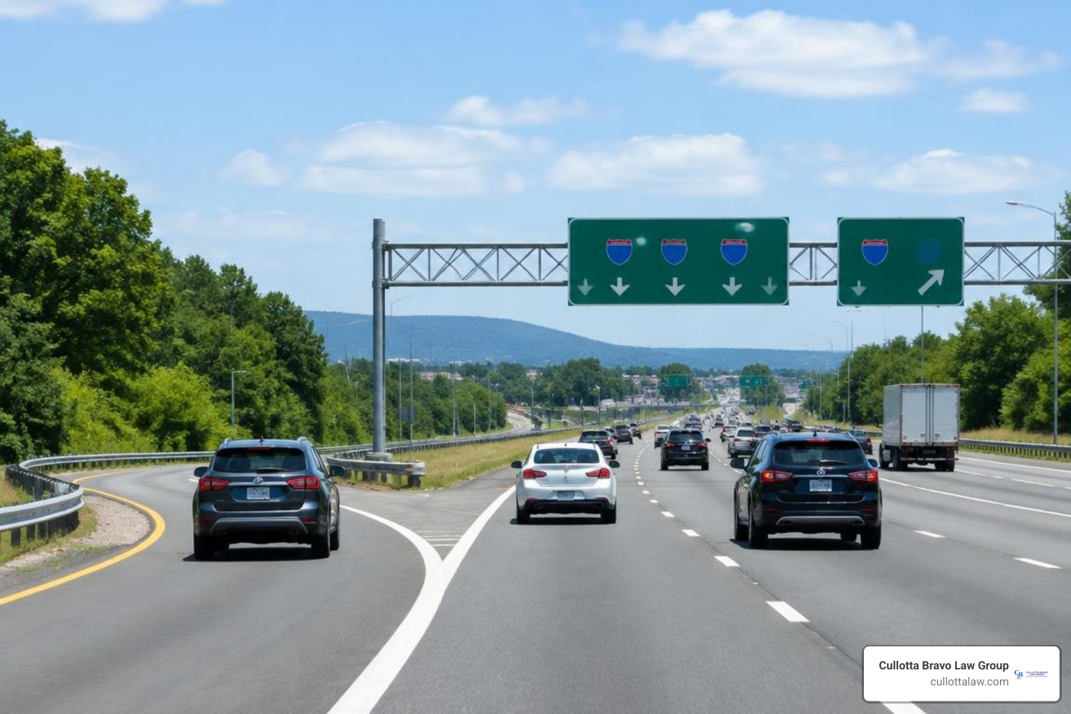
Auxiliary lanes are supplementary strips of pavement connecting an on-ramp to the next off-ramp. They provide dedicated space for entering drivers to accelerate to highway speeds and for exiting drivers to decelerate without disrupting through-lane traffic. On steep uphill grades, auxiliary “climbing” or “crawler” lanes allow heavy commercial trucks to downshift without blocking faster passenger cars.
Shoulders serve as emergency stopping zones and staging areas for first responders. On modern “smart motorways” and active-traffic-management corridors, overhead digital gantries display variable speed limits and red “X” lane-closure warnings. During peak rush hours, transportation officials can even open the hard shoulder for temporary travel to clear bottlenecks.
Highway Lane Width and Geometric Cross-Section Standards
The width and structural design of a highway lane directly affect driver comfort, operational speeds, and crash rates. According to the FHWA 2024 Highway Statistics, the United States contains 8,865,889 total lane-miles of roadway. The Interstate system accounts for 231,104 lane-miles, while Federal-aid highways make up 2,520,159 lane-miles. Managing this massive footprint requires consistent engineering standards across every jurisdiction.
Standard Lane Widths by Speed and Functional Class
Lane width guidelines balance safety, land availability, and speed. Highway design manuals, such as the WSDOT Geometric Cross Section Guidelines, use a “design-up” approach to match lane dimensions with vehicle volume, heavy truck traffic, and target speeds:
- 12-Foot Lanes: Standard on rural and urban Interstates with speed limits of 50 mph or higher. This width provides adequate lateral clearance for large commercial semi-trucks, buses, and high-speed passenger vehicles.
- 11-Foot Lanes: Common on principal urban arterials and state highways with target speeds between 35 and 45 mph. They maintain safety while fitting tighter right-of-way boundaries.
- 10-Foot Lanes: Used on constrained urban corridors, low-speed collectors (35 mph or less), and areas where traffic calming is required to protect adjacent multimodal users.
Complete Streets and Road Diet Lane Reallocations
In suburban and urban settings, highway departments often convert oversized four-lane undivided roadways into three-lane profiles—a process known as a “road diet.” This setup creates one travel lane in each direction, a dedicated center two-way left-turn lane (TWLTL), and expanded shoulders or buffered bike lanes.
Road diets reduce rear-end and left-turn collisions, create safer pedestrian crossings, and organize traffic without sacrificing vehicle throughput on corridors carrying fewer than 20,000 vehicles per day.
Markings and Signage Governing Highway Lane Usage
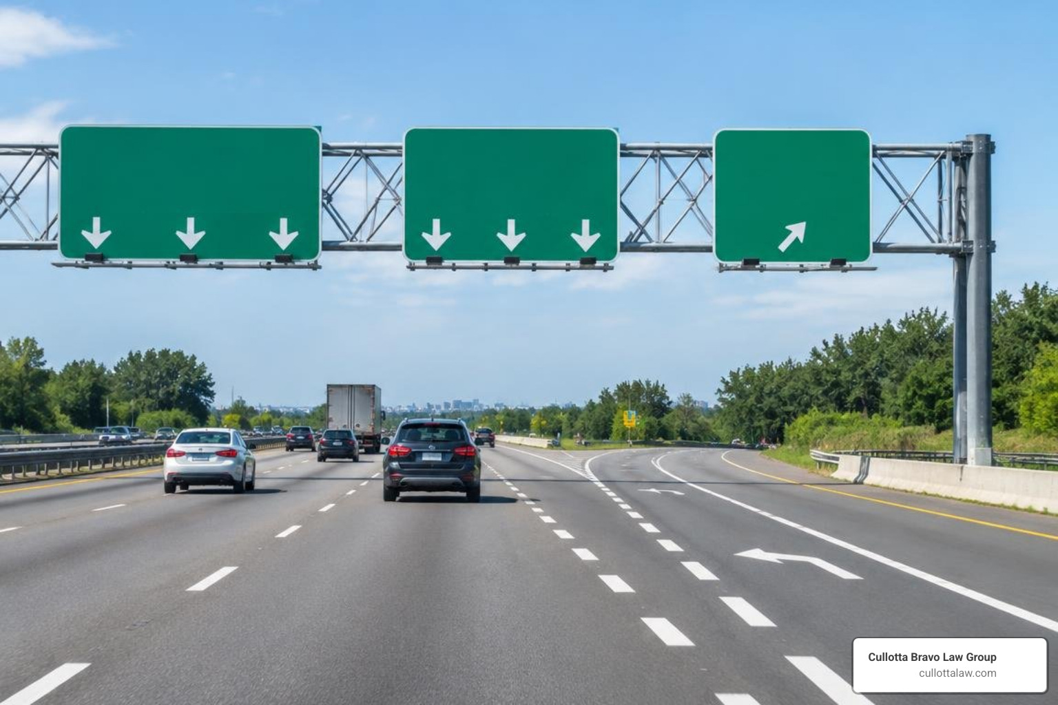
Pavement markings and signs communicate the rules of the road at a glance. When drivers fail to interpret lane lines or ignore overhead lane assignments, the risk of serious collisions rises sharply. If you have been hurt by a careless driver who drifted across markings, our team can help you understand your legal options by understanding common accident causes and holding negligent motorists accountable.
Deciphering Highway Lane Markings and Gore Areas
Highway markings use colors and patterns to organize movement:
- Broken White Lines: Separate lanes of traffic traveling in the same direction; passing and lane changes are permitted when safe.
- Solid White Lines: Mark the right road edge (fog line) or discourage lane changes between lanes moving the same direction.
- Solid Double White Lines: Strictly prohibit lane changing; frequently used to isolate managed or express lanes.
- Broken / Solid Yellow Lines: Delineate opposing traffic directions.
- Wide Dotted White Lines: Warn drivers of an impending lane drop or mandatory exit.
The triangular space between a through highway lane and an exiting ramp is called the gore area. The MUTCD Freeway Lane-Drop Application Standards outline how solid white channelizing lines and optional chevron markings protect this neutral zone. Crossing the gore line to make a last-second exit is illegal and a frequent cause of severe rear-end crashes. You can read more about lane line definitions in our guide to deciphering highway striping.
Preferential Signage and Work Zone Lane Shifts
Highway regulatory signs reinforce lane-use rules:
- Diamond Symbols: Indicate preferential lanes reserved for HOVs, clean fuel vehicles, or public transit.
- Advance Occupancy Signs: Installed at least one-half mile before managed-lane access points to let drivers verify passenger requirements.
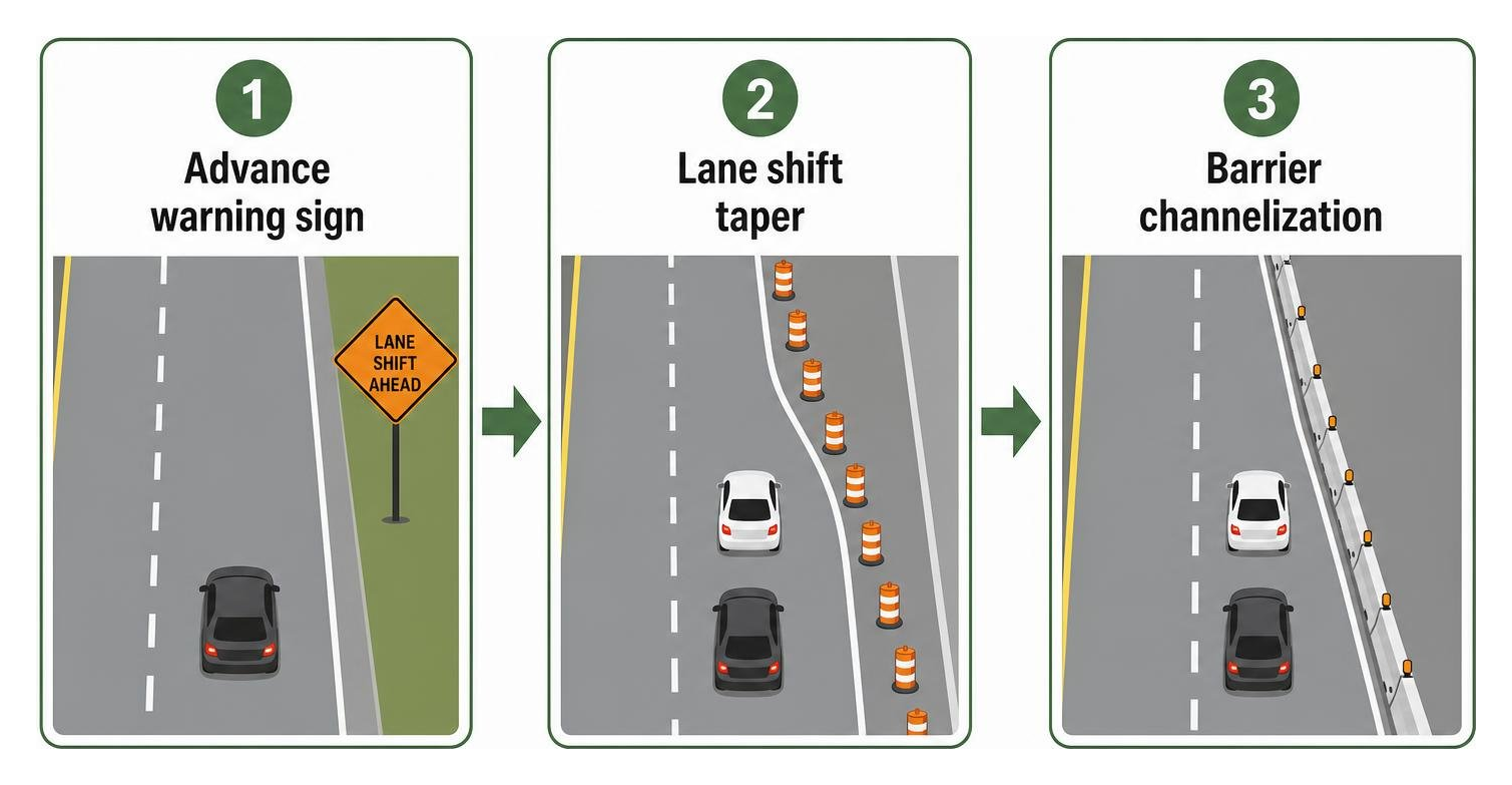
- Work Zone Lane Shifts: Under the MUTCD Freeway Lane Shift Standards, construction zones use temporary angled edge lines, channelizing drums, and crash cushions to guide traffic safely around work areas.
Legal Rules, Safe Driving Practices, and Capacity Management
Smooth highway flow depends on every motorist following basic lane discipline. When drivers weave abruptly, tailgate, or linger in passing lanes, the resulting friction causes phantom traffic jams and multi-vehicle pileups.
State Lane Discipline and Automated Vehicle Regulations
Most states enforce “keep right” laws. Under statutes like Michigan Vehicle Code Section 257.642, drivers must remain in the rightmost lane on multi-lane roadways except when overtaking, preparing for a left exit, or navigating around road hazards.
State laws also govern center lanes on three-lane roads, restricting them to passing or left-turn maneuvers. With connected and automated vehicles (AVs) rolling out, several states have established dedicated automated vehicle lanes with specific registration, operating, and fee guidelines.
Navigating Blind Spots and Preventing Lane-Change Crashes
Commercial semi-trucks have massive blind spots—called “No-Zones”—along their front, rear, and both sides. A fully loaded tractor-trailer cannot stop quickly or swerve to avoid a vehicle riding beside its trailer tires.
Reviewing semi-truck blind spot diagrams helps drivers visualize these danger zones and leave adequate buffer space. Understanding navigating commercial vehicle no-zones is essential for avoiding catastrophic sideswipes when merging near freight traffic on regional highways.
Frequently Asked Questions About Highway Lanes
What is the standard width of a highway lane in the United States?
On Interstate freeways, the standard lane width is 12 feet, which accommodates 8.5-foot-wide commercial tractor-trailers plus mirror overhangs and safety buffers. On state highways and urban arterials with lower speed limits (under 45 mph), lane widths typically range from 10 to 11 feet.
Why is there no official “fast lane” on modern freeways?
Traffic laws do not establish a “fast lane.” All lanes share the same posted speed limit unless variable-speed signage indicates otherwise. The leftmost lane is legally designated as a passing lane (or overtaking lane). Cruising continuously in the left lane—even at the speed limit—can impede traffic flow and result in a citation.
What is the difference between contiguous and barrier-separated managed lanes?
- Contiguous Managed Lanes: Run directly adjacent to general-purpose lanes, separated only by pavement striping or double white lines.
- Barrier-Separated Managed Lanes: Separated from general traffic by physical concrete barriers, pylons, or landscaped medians, using dedicated direct-access ramps to eliminate side collisions.
Conclusion
Understanding highway lane functions, markings, and legal rules helps keep our roads safe and predictable. Safe driving comes down to the basics: respect lane-drop signs, stay out of blind spots, use turn signals well before changing lanes, and leave the left lane open for passing.
When other drivers ignore lane rules, speed through work zones, or make reckless lane changes, the resulting crashes can be life-changing. At Cullotta Bravo Law Group, we have spent more than 35 years securing multi-million dollar settlements and aggressive legal recoveries for injured victims in Chicago, Aurora, Naperville, and Joliet. If you or a loved one has been hurt in a highway collision, check out our guide on the safest lane to travel in on the highway or contact our team for a free consultation.